HOME > ژتگ^ > ڈو‚蕨پEŒً’ت > Œً’تƒCƒپپ[ƒW > ’nگ}
10,000Œڈ‚جژتگ^‘fچق‚ھŒںچُ‚³‚ê‚ـ‚µ‚½پB
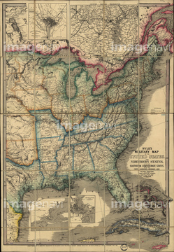
‚±‚جŒںچُŒ‹‰ت‚ة‚حپATexas, Oregon & California - 1846پATexas - 1846پAA map of the moon based on observations.پANaval Military Map of the United States 1862پAMexican War Battle Map - 1848پAMexico & California - 1742‚ب‚ا‚ھٹـ‚ـ‚ê‚ؤ‚¢‚ـ‚·پB

51435710
51436132
51435709
51435712
51435714
51435708

51435715
51435717
51436103
51435824
51436081
51436082
51436108
51436326
51436034


51435711
51436675
51436083
51436084
51436085
51436086
51436087
51436088
51436089
51436090
51436091
51436092
51436093
51436095
51436096
51436097
51436098
51436099
51436100
51436101

51436102
51436104
51436106
51436109
51436110
51436642
51436699
51436033
51436032
51906853
51436113

51436111
51436631

51436107
51435742
51436059
51435821

51436651
51417253


51906179
51436080
51435707
51436094
51436105
51436114
51436115
51436036
51436288


64052698
51437204

51423095
51436796

51421894

51421906
51435778

64055075

64052693
51435881
51497193
51435846
51436328
51436330
51436331
51436332
51436371
51436374
51435805
51435814
51435823
51435825
51435883
51435885
51435886

51436216


51435781


51436073

51436419

51436420

51436663

51435668
51435672
51435675
51435680
51435685

51435692
51435693
51435706
51435804
51435809
51435810
51435811
51435815
51435847
51435852
51435853
51435854
51435855
51435858
51435859
51435861
51435862
51435863
51435864
51435867
51435869
51435870

51435872

51435873
51435879
51436000
51436001
51436004
51436386
51492872


51426610

51436542
51905714
51436732
51430884
51436028

51476014

64052655

51436058
51436063
51436072

51436280
| ژںƒyپ[ƒW |
