HOME > ژتگ^ > ڈو‚蕨پEŒً’ت > Œً’تƒCƒپپ[ƒW > ’nگ}
10,000Œڈ‚جژتگ^‘fچق‚ھŒںچُ‚³‚ê‚ـ‚µ‚½پB
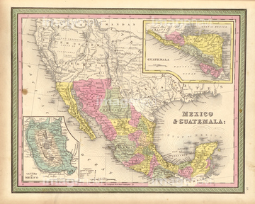
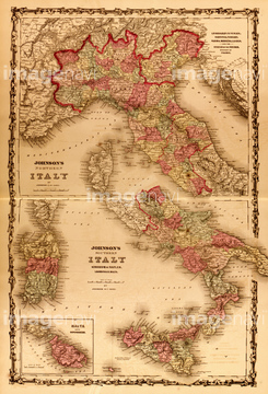
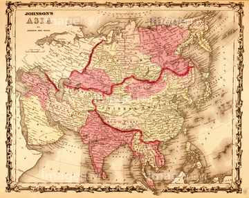
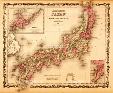
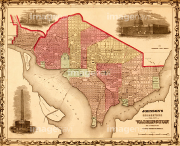
‚±‚جŒںچُŒ‹‰ت‚ة‚حپAJapan 1862پAChina 1862پANorth America - 1862پAEngland & Wales 1862پAMinnesota & Dakota - 1862پAWashington, DC - 1862‚ب‚ا‚ھٹـ‚ـ‚ê‚ؤ‚¢‚ـ‚·پB
51435823
51435824

51436074
51435821
51436076
51436077

51435814
51435825
51435826
51435835
51435841
51435810
51435815
51435831
51435844
51435840
51435886
51436034
51436086
51436087
51436090
51436091
51436092
51436093
51436095
51436096
51436098
51436099
51436100

51436102
51436106
51436108

51436326
51436331
51436371

51436699
51435830
51435833

51435838
51435845

51435662
51435839
51435842
51435843
51435809
51435827
51435807
51435818
51435820
51435822
51435829
51435811
51435778
51435805
51435883
51435885
51436059
51436081
51436082
51436083
51436084
51436085
51436088
51436089
51436097
51436101
51436103
51436104
51436109
51436110
51436328
51436330
51436332
51436374
51436642
51435813
51436078
51435816
51435828
51436539

51435781


51435542
51435555
51435668
51435672
51435675
51435680
51435685

51435692
51435693
51435706
51435853
51435854
51435855
51435858
51435861
51435862
51435863
51435864
51435869
51435876
51435888
51435893
51435900
51435905
51435906
51435913
51436000
51436004
51436164
51436208

51436216

51436223

51436288
51436304
51436305
51436311

51436333
51436338
51436343
51436344
51436345
51436350
51436351
51436352
51436353
51436357
51436359
51436394


51436633

51436663

51435817
51436028
51436468
51436507
51430884
51436385
51435742
51436601
51436781
51436631
51435709
51435712
51435714
51436033
51436063
51436094
51436113
51436253

51436280

64052655
51436542
51436503

51435740

51435741
51436032
51436036
51436060

51436111
51436114
51436115
51436370
| ژںƒyپ[ƒW |
