HOME > 写真 > イラスト・CG > 美術 > アールヌーボー・アールデコ
10,000件の写真素材が検索されました。
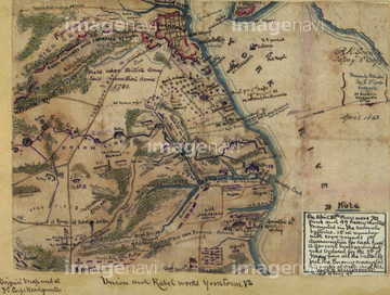
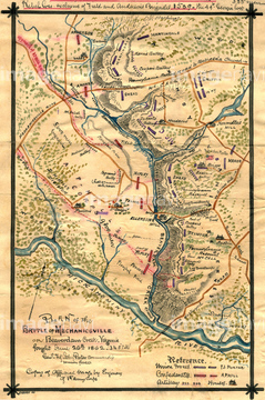
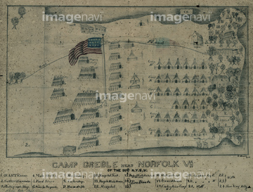
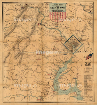
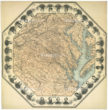
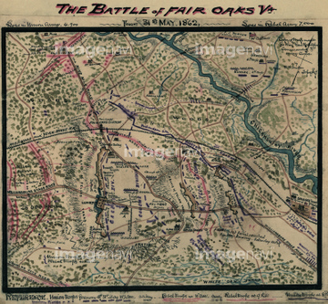
この検索結果には、Camp Misery - Rebel Fort 1862、Union and Rebel works Yorktown, Va. 1862、Battle of Mechanicsville or Beaverdam Creek 1862、Camp Greble near Norfolk, Va. 1862、Army Map - Theatre of War - 1862、Eastern, Virginiaなどが含まれています。
51910874
51904156
51910873
51901348
52228583
51911690
51911530
51911532
51910669
51911684
51901004
51911537
51911539
51911540
51911541
51911542
51911543
51911668
51911675
51911702
51909763
51911553
51911622
51911636
51436541
51911691
51909986
51980218
51901384
51902806
51436542
51436422
51436524
51436433
51436448
51436473
51436513
51436572
51436495
51911544
51911545
51911546
51911551
51911693
51911694
51909740
51910053
51905729
51908283
51901565
51901912
51903038
51903663
51910479
51911529
51911531
51911533
51911534
51911549
51911552
51911621
51911624
51911626
51911627
51911630
51911661
51911670
51911673
51911677
51911678
51911680
51911686
51911704
51917410
51912065
51903086
51903926
51914531
51901002
51904647
51904648
51436543

51436573
51436577
51436463
52229163
51436430
51436431
51436434
51436459
51436487
51436602
51436546
51905576
51436435
51911538
51911620
51911695
51911698
51911700
51903234
51905584
51911628
51911671
51911679
51911681
51911682
51911685
51911687
51911688
51911699
51911703
51909754
51902666
51929995
52100656
52103629
51906049
51910049
51911701
51911057
51903381
51904650
51902449
51900808
52227668
51417106
51911683
51911697
51911002
51911380
51911381
51914555
51436423
51436424
51436427
| 次ページ |
