HOME > 写真 > 地図・衛星写真 > 衛星写真 > 世界遺産
10,000件の写真素材が検索されました。
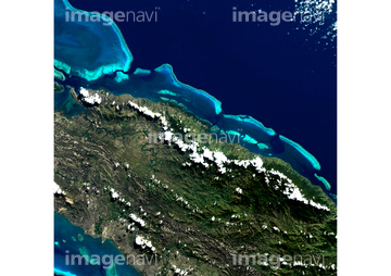
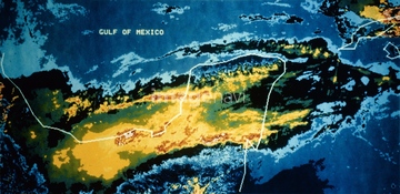
この検索結果には、メキシコ湾に浮かぶ珊瑚礁、キリバス、プリンセスシャーロットベイ、ナウル、アリ環礁、ベリーズ珊瑚礁保護区などが含まれています。
63030400
63030817
63030390
63030673
63030809
63030626
63030548
63031031
63030455
63030062
63030149
63030453
63030215
63030315
63031607
63031574
63030529
63030617
63030485
63030457
99046046
63031006
63030983
64139867
63030097
63030077
63031004
63030049
63031068
17200245
63030458
63031712
63031575
63030177
63031606
63031103
63030333
63031683
63031273
64013509
63030522
30399055
63030098
63030212
63030242
30926264
63030207
63030581
63031424
63030201
63030213
63030608
64179588
64179589
63030108
63031714
41100020
41100021
41100022

63031573
63031715
63031303
63030044
63030547
12410677

63030249
41099827
41099828
41099829
41099830
41099831
41099832
63030711
63031005
41455289
41455290
63031066

64014989

30029236
63030623
64259408
30402956
63030199
41099824
41099825
41099826
00008403
64094261
63030479
63031909
63031910
63030184
63030236
63031102
64014984
63030161
63030671
41099998
41099999
41100000
63030074
63030155
63030244
40860899
40861058
63031727
63031747
63030094
20923074
63030227

63030433
63030486
63030710
63031003
63030620
63030819
64265234
63030169
21511166
63031612
63031069
63030403
63030818
63030389
30000916
63031722
63030550
63030399
63030105
63030406
63030520
63030223
63030417
99021011
12410679
63030537
63030607
63031902
63030505
63030979
63031039
30402955
63031412
63030890
63031435
63030150
63030397
63031076
63030858
17200271
63030405
63030595
63030601

64014988
64124681
40860446
40861059
63030849
64014981
64124666

64124667

64124678

64124679
41123715
41123716
41123717
63030683
63031711
| 次ページ |
