HOME > 写真 > 自然・風景 > 宇宙 > 地球
10,000件の写真素材が検索されました。
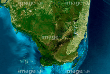
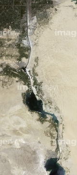
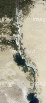
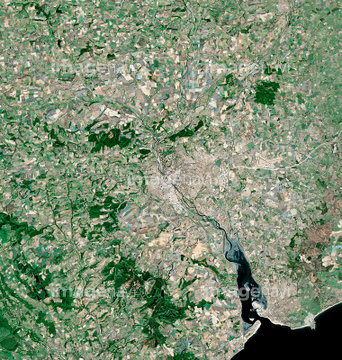
この検索結果には、ランドサット日本列島、Dead Sea 1984-2011、Exeter, satellite image、Mantua, Cuba, satellite image、Metz, satellite image、The Arctic, satellite imageなどが含まれています。

64067342

64067344

64067343

64105661

64057572

64053686

64074902

64075072

64075073

64059203


64075415

64105663

64014831

64057571

64057574

64057614


70571190

64057582

64057586

64057617

64067341

64075837


64210710

64040012

64040015

64011214

64011231

64210700
64075416
64011103

64102918
64105664
64075178

64040011

64040016

64074792

64014155

64014193

64016884
64016965
64215906
64215913

64045766


64098684


64057573

64057613
64009999
64010004

64010005

64040007

64040010

64011215

64011098
64059199
64059200
64059201
64059204
64059205
64059206
64059207
64059208
64059209
64059210
64059211
64059212
64059213
64050576


64014196

64016257
64011101

64098673

64098688

64098690

64098804

64253111

64253112


64051876

64009992
64009996

64010000
64010006
64010100

64075190

64086680

64040013

64040014

64074794

64011221

64011223

64011225

64011229

64065656
64067340

64041386

64041387

64041388
64050064

64016256


64075684
64090800
64011181
64050204

64040008

64040009

64041383


64041390

64074793

64074795

64011203

64011211

64011230


64076181

64075588

64075590

64098680

64098681


64098702

64098806

64098807

64098808

64100584


64149307


64057615
64064291
64064294
64010007

64243149

64049194


99074193
64026179
64026180
70571204
64040017


64060109

64060110
64077531


64016964
64096984
64096989
64096990
64096992
64096995
64115716
64115717
64115723
64115727
64115731
64077181
64077187
64081342
64081358
64081361
64059386
64061999
64062000
64062002
64062003
64062005
64062047
64062048
64062049
64062051
64062052
64062352
64062353
64062356
64062357
64062365
| 次ページ |
