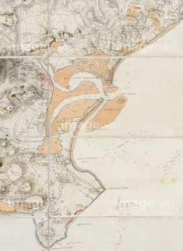
Port of Alicante
Siberia
Map of East Coast of Canada, 1745
Plan du Port de Candiu
Mediterranean and Black Seas
Mediterranean Sea and Black Sea
Map of the Ancient World
The River of Tyne
Plan of Chatham Lines
Parish of StDunstan
A Prospect of London
Coast of France
Chart of Western Europe
Bishoprics of Durham and Northumberland
London
Pascatway River
Dunham on the Hill
Russia
Sea of Marmara
The south coast of England
Universalis Orbis Hydrographia
False Bay
Gujarat coast
Londinium
River Thames
Map of Guinea Coast, Africa, circa 1700
Venice
Map of Pokutia
Map of Cuautitlan River, Mexico
Map of Il Mari di Amazones, 1646
The Bay of Manila
East Coast of the Malay Peninsula
Malabar and Coromondel
Gibraltar
Black Sea
Wales
Scotland
Chart of South East Asia
Ubersichtskarte von Mitteleuropa, Overview map of Central Europe, but Mainly showing Northeast France, 1912
A plan of Chatham
Plan of Paris, France in 1789
Encampment on Waterdown Forest
Grand Canal, China
Arkansas
Ethnological And Philological Map Of Africa As It Was In The 19Th Century
Queen Mary atlas
Mediterranean area
Western Mediterranean Sea
Plan of Limerick
Plan of the Mutsyoduree Tunnel
Map of Terrae Del Evogo Pars
The Bay of Panama
West coast of America
A chart of Cuba
East Coast of North America
South Channel of Orleans, Quebec
Gulf of Mexico and West Indies
Chart of Mediterranean
Allegorical map
Germaniae Cisrhenanae ut Circa Julii Caesaris Suit Aetatem, Descriptio, Map of German Empire to West of the Rhine River, into Belgium and France, during the time of Julius Caesar, by German Geographer Philipp Cluver, Published in Germaniae Antiquae Libri
Chart of the coasts of Europe
Map of Greek and Phoenician settlements in the Mediterranean basin circa 550 B
Chart of the Eastern Atlantic
Pacific Ocean
North Atlantic coast of America
Map of Osaka
Chart of the Persian Gulf
Southern coast of South America
Mesopotamia
Lappia and Bay of St Nicholas
Chart of the South Pacific Ocean
A Map of a New World
Zodiac chart
The North seaA chart
The River Schohary
Manila
Map of Ancient Egypt, Illustration, Cyclopaedia of Universal History, Volume 1, The Ancient World, by John Clark Ridpath, the Jones Brothers Publishing Company, 1885
Glasgow
France with New Region Boundaries, Natural Colour Satellite Image
Map Of Yorkshire
State of Saarland, Germany, True Colour Satellite Image
Insurance Plan of Londonderry
Map of Mount's Bay in Cornwall
London and Westminster
Essex
Cholera map
The River Thames
Map Of The Southern United States Of North America Circa 1760
Map Of Western Canada Including The Five Great Lakes
Cyprus, Satellite Image With Bump Effect
Cyprus, True Colour Satellite Image
France and the Region of Upper Normandy, Satellite Image With Bump Effect
France and the Region of Upper Normandy, True Colour Satellite Image
France and the Region of Nord-Pas de Calais, Satellite Image With Bump Effect
France and the Region of Nord-Pas de Calais, True Colour Satellite Image
Region of Nord-Pas de Calais, France, True Colour Satellite Image
South-east England
The River Clyde
Currents in the Indian Ocean 1848
Southern United States Map, Harper's History of the Rebellion, Lithograph
France and the Region of Pays-de-la-Loire, Satellite Image With Bump Effect
France and the Region of Pays-de-la-Loire, True Colour Satellite Image
France and the Region of Poitou-Charentes, Satellite Image With Bump Effect
France and the Region of Poitou-Charentes, True Colour Satellite Image
Views and plans of Royal Bay
THE MOON, 1671.
West Indies Islands, Historical Map, circa 1893
Nova Scotia
Central America and West Indies
The Chagos Archipelago
Japanese Buddhist world map
Nagasaki
Section of a globe
Physical Chart of the Pacific Ocean 1848
France and the Region of Auvergne, True Colour Satellite Image
France and the Region of Auvergne, Satellite Image With Bump Effect
Map of Andalusia Spain
Map of the World, 1848
Map illustrating the localities of origin or occupation, and gradual advance of the Barbaric Nations
State of Mecklenburg-Vorpommern, Germany, True Colour Satellite Image
The operations round Kut-al-amara
Map of the Indian Ocean
WORLD MAP, c1490.
The Great Lakes
Map of Germany in 1815
Map of Great Britain showing the dominions of William the Conqueror, circa 1087
Germany and the State of Saarland, True Colour Satellite Image
Belgium and the Walloon Region, True Colour Satellite Image
Walloon Region, Belgium, True Colour Satellite Image
British Isles, Waves, High Water & Tides 1848
ST. PETERSBURG, RUSSIA.
Map of Moscow, "Atlas Geographicus et Topographicus", 1643
A Map Of Africa As Depicted During The 8Th Century Bc
Map of Ancient Greece, 500 - 300 BC
Map of the New World, Hennepin's Map of 1683
Westminster
Illustration of Cusco, Peru
VIEW OF LOS ANGELES, 1871.
Map of North Pole, 1747
Map Showing The Average Density Of The Population Of The United States Of America In 1880 And Of The Dominion Of Canada In 1881
Skeleton Map Of South And Central Africa Showing David Livingstone's Discoveries
Map of Thermopylae, Greece
Map of Olympia, Greece
Ethnographic Map of Europe 1848
Mountain Systems of Europe 1848
Map of Spain and Portugal circa 1872
Plan of Athens, Greece circa 200 AD
River Systems of Asia & Europe 1848
Map of Mycenean Greece and the Orient circa 1450 B
Map of Asia Minor under the Greeks and Romans
Spain and the Region of Madrid, True Colour Satellite Image
Spain and the Region of Extremadura, True Colour Satellite Image
District of Castelo Branco, Portugal, True Colour Satellite Image
District of Evora, Portugal, True Colour Satellite Image
District of Portalegre, Portugal, True Colour Satellite Image
Spain and the Region of Madrid, Satellite Image With Bump Effect
Spain and the Region of Extremadura, Satellite Image With Bump Effect
Spain and the Region of La Rioja, Satellite Image With Bump Effect
Spain and the Region of La Rioja, True Colour Satellite Image
Region of Upper Normandy, France, True Colour Satellite Image
A view of Bergen
Map of the Assyrian Empire and the region around the eastern Mediterranean, 750 - 625 B
Region of Poitou-Charentes, France, True Colour Satellite Image
Region of Pays-de-la-Loire, France, True Colour Satellite Image
Renaissance map of Europe, Jacopo Russo.
Map of America
New York and Vicinity Map
Gingerah (Donda Rajapore)
Wexford Harbour
Region of Auvergne, France, True Colour Satellite Image
Kerguelen Islands, France, Natural Colour Satellite Image
Map of north america
Map of south america
New England
Australasia and south-eastern Asia
Germany and the State of Mecklenburg-Vorpommern, True Colour Satellite Image
Belgium, True Colour Satellite Image With Border and Mask
Belgium, True Colour Satellite Image With Border
Belgium and the Flemish Region, True Colour Satellite Image
Flemish Region, Belgium, True Colour Satellite Image
Northern Ireland, United Kingdom, True Colour Satellite Image
State of Mecklenburg-Vorpommern, Germany, Relief Map
France and the Region of Picardy, True Colour Satellite Image
Region of Picardy, France, True Colour Satellite Image
France and the Region of Picardy, Satellite Image With Bump Effect
State of Lower Saxony, Germany, True Colour Satellite Image
State of Schleswig-Holstein, Germany, True Colour Satellite Image