HOME > 写真 > 地図・衛星写真 > 古地図 > 世界の古地図
10,000件の写真素材が検索されました。
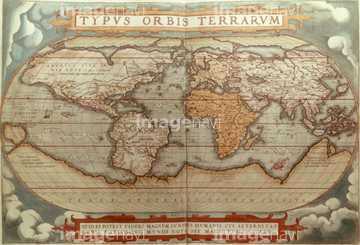
この検索結果には、America 1600、Nova Orbis Tabula 1680、Countie of Leinster (Ireland) 1675、Novi Belgii Novaeque Angliae 1655、Nova Totius Terrarum Orbis 1630、North Atlantic region, 1630などが含まれています。


51411451

51411460

51411522

51411463

51411521


51411444

51411445

51411446

51411447

51411453

51411454

51411455

51411466

51411467

51411469

51411470

51411503

51411516

51411448

51411457

51411459

51411468

51411505

51411506

51411508

51411509

51411513

51411523

51411524

51411449

51411452


51411461

51411462

51411464

51411465

51411502

51411504

51411511

51411512


51411517

51411518

51411519

51411520


51411456
51411507

51405941

51405946

51410014

51410015

51410019

64055083


64149791

51435930

64089037
51903609
64045004


64052692

64055081

51435729

51435747

51436112

51436182


51436287

51436290

51436398

51436414


51422966
51903029
51903218
51904052
51902365

64052655

51435535


51405927

51405928

51405929


51405937


51405939

51405944

51405945

51410020
51436691
64047300

64055082
51436317
51436229

51436308


51436205


51430900

51435740

51435741


51436021

51436026

51436074

51436111

51436129

51436130

51436153

51436158

51436166

51436315

51436319
51906147

51901369
51902605

64055079
64046155
64046156
51436363
64042279
64042280
64042282
64042283
64042284
64042285
51902154
51930910
51435598
51435631
51435689
51426600
51435947

64245773


51435558

51435559

51435560

51435561

51435562

51435565


51435720

51435721

51435722

51435723

51435724

51435725

51435726

51435727

51435728

51435730

51435731


51435734

51435735

51435738

51435739

51435917


51435921


51435924

51435925


51435929

51435931

51435937

51435938


51436174


51436293
| 次ページ |
