HOME > 写真 > 地図・衛星写真 > 古地図 > 世界の古地図
10,000件の写真素材が検索されました。
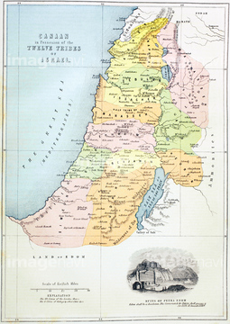
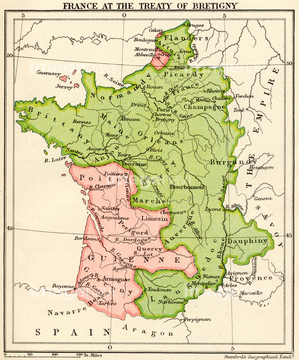
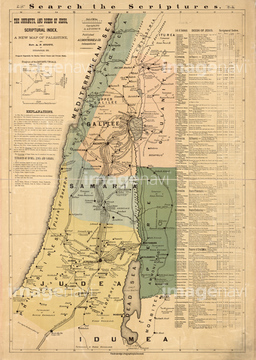
この検索結果には、Palestine & Adjacent Countries - 1844、Palestine & Adjacent Countires - 1849、Palestine - 1862、Map of Britain in the midst of the English conques…、Map of the Holy Land、Map of France at the Treaty of Bretignyなどが含まれています。

51422780
51422779
51436142

64055077

51436143
51436144
51417096

51422778

64055078
51436141
51436139

51422774


51436137
64082664


51436651

51422776
51916519
51902260
51916520

51436419


51414341

51414342

51414345

51414346

51414352

51414362

51405937
51435637


51436216

64055079

51466437

51422887

51405939

51417134
51422391


51435838
64082739

51414338

51414339

51414340

51414343

51414344

51414347

51414348

51414349

51414350

51414351

51414353

51414354

51414355

51414356

51414357

51414358

51414359

51414360

51414361

51414421

51414422

51414423

51414424

51414425

51414426

51414427

51414428

51414429

51414430

51414431

51414432

51414433

51414434

51414435

51414436

51414437

51414438

51414439

51414440

51414441

51414442


51423095

51422843
51436132


51436420
51435595
51435616
51435620
51435642

51436129


51435576
51435583
51435614
51435625
51435638
51435640
51436347

64055082

64055073

64052655

64052692
51423139
51902854
51902300

51422942

51411448

51411513

51411449

51411465

51411504

51411511

64055074

64055075
51436136
51435876

51435904

64082654
51417072
51417109
51417110
51417143
51417152
51417149
51417138
51417178
51417159
51417162
51417101
51417168
51417218
51417222
51417226
51417255
51417262
51417266
51417299
64082656
51435575
51435861

51436130
51435570
51435585
51435590
51435608
51435639
51435641
51435646

51405927

51405928

51405929


51405941

51405944

51405945

51405946

51410014

51410015

51410019

51410020
51417161
51436076
51417203
51435577
51435578
51435579
51435582
51435587
| 次ページ |
