HOME > 写真 > 自然・風景 > 宇宙 > 地球
10,000件の写真素材が検索されました。
この検索結果には、La Nina, December 2010、European severe storm, isobar diagram、Earth and Moon, artwork、Global winds, satellite-based diagram、Earth's atmosphere, cutaway Earth globe、Thunderstorms, space shuttle imageなどが含まれています。

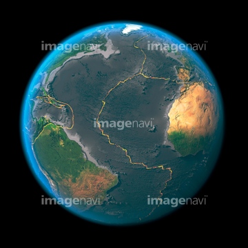
64067291
64067283


64067292

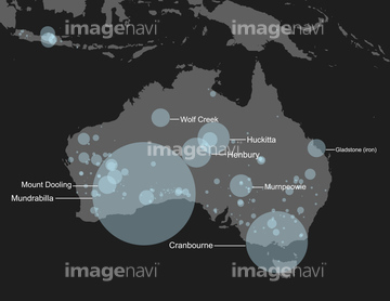
64067293

64067282
64067288


64040182

64040183

64040184
64067302

64067303
64067300
64011194


64040980
64067564


64067286
64067281
64067284

64053684

64058420

64058421

64041392


64088728

64152465

64242042

64218473


64061242

64062174

64062175

64062373

64044426

64044427

64044794

64044795

64044796

64047887

64047888


64014702


64067330

64067331

64067805


64011490
64011204

64043083
64096326

64075201


64109527

64109558

64040166

64040203

64040204

64040205

64040206

64041230


64075588

64075590

64041391

64041387

64086444


64152471

64061241

64046145


64168208


64260136

64185232

64185233

64185234

64185238

64185239

64185240

64185236


64014771
64011489


64011207

64067275

64046391

64053325

64041386

64041388
64190764

64109443

64109465

64041383

64041390


64087817

64123560
64123571
64252934

64045782

64047110


64041895

64072484

64072485

64072486

64072487


64072490

64072491

64072492


64072494

64072495

64072496


64106283

64087823

64109227

64109563


64218100

64057054

64061234

64061235


64053700
64096987

64097527
64096325


64062204
64123565
64123566

17200257


64011192

64067337

64086443


64041342

64041345

64073758

17200258


64214597
64045775

64053686

64066108

64066109

64066110

64066111


64066113


64067274

64067276

64067277


64067279


64051876
64129763

64263237

64185235
| 次ページ |
