HOME > 写真 > 自然・風景 > 宇宙 > 衛星
10,000件の写真素材が検索されました。
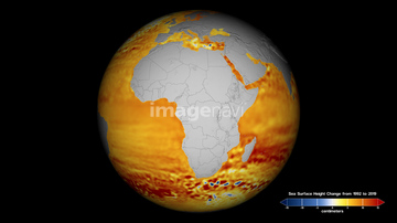
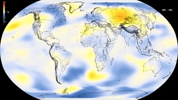
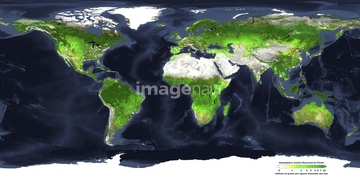
この検索結果には、Global sea level rise, 1992-2014、Disko Island, Greenland、Saunders Island, Greenland、Arctic sea ice at lowest maximum, 2015、Northern Hemisphere forest coverage、2010 Eyjafjallajokull eruption, Icelandなどが含まれています。

64088450

64260979

64106283

64204970


64105772


64215904
64255401
64257399
64257411
64204971
64204972
64247623
64128970

64264125
64141450
64162892

64178179
64253423
64046247
64253422
64253424
64253425
64253426
64253427
64253428
64169502
64154867
64125750
64105948

64059717
64077812
64112898
64112899
64190780
64107663
64091482
64105953

64105944

64109422

64014421

64073495
21588965
64190779
64109560

64105947
64130389
64196794
64196795
64196796


64015247

64058420

64058421
64091478


64112895
64201796
64201797
64201798
64201799
21588937
21589005
21589007

64185242


64112900

64109527

64109558
64091484
19449358
19449361
19449363

64185233

64185234

64185235

64185236
64185237

64185238

64185239

64185240
64120928
64203129
64203130
64109488

64109489
64109490
64093948
64181281
64181282

64106823
64014677
64015237
64015238
64015245
64210089
64015239
64015240
64015241
64015242
64015243
64015244
64015246
64077155
64112894
20543664
20543741
64100590
64242357
24706826
24706827
24706828
24706829
24706830
24706831
24706832
24706833
64122031
64122117
64015139
64014573


| 次ページ |
