HOME > 写真 > 科学・テクノロジー > 科学
10,000件の写真素材が検索されました。
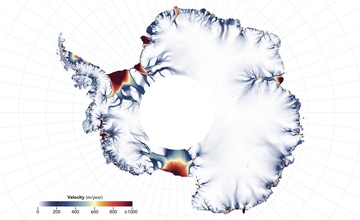
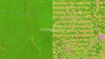
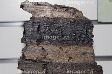
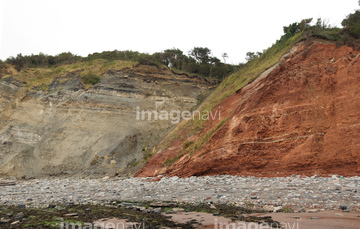
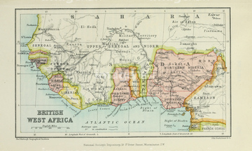
この検索結果には、Antarctic ice sheet activity, 2014-2018、Deforestation in the Amazon 1975 to 2012, satellit…、BOUNDARY IMPACT EVIDENCE、Fault at Blue Anchor、Sandstone cliffs、Map of British West Africaなどが含まれています。
64041301
64202061

64043083
64146823
64146824
64146825
64146827
64146826
64248560
64248558
64248562
64248563

64085877

64085878
64146828
64146829
64235057
64159715
64159716
64053496
64097334
64097335
64022873
64112752
64047749

64048838
64048839
64041231
64044480
64044481

64248988
64248989

64146819
64146820
64146830
64095580
70118877
64092217
64015648
64248554
64016072


64113773
64073566
64022874
64022875
64022876
64022877
64022878
64015624
64015625
64015626
64015635
64016016
64016053
64016058
64016097
64146859
64113708
64113763
64113776
64113777
64113778
64113783
64113801
64193221
64193222
64193245
64258630
64246539
64203008
64130296
64261338
64096326
64233298
64217395
64189170
64245773

64138495


64041895

64087817
64158205
64044695
52205777
64015645
64195135
64059380
64128602
64193865
64191583


64043123
64089685
64261339
17293009

64126231
64126232
64126233
64126234
64116148
64015408
64015409
64015636
64015653
64113165
64113761
64113772
64113774
64113775
64113797
64117651
64117652
64100083
64096325
64094204
64094205
64233290
64233292
64102312
64128676
64189171
64189172
64189168
64189169
64189173

64053686


64053684


64041386

64041387

64041388


64098677

64098678
64248335
64156623
64050109
64016408
64016409
| 次ページ |
